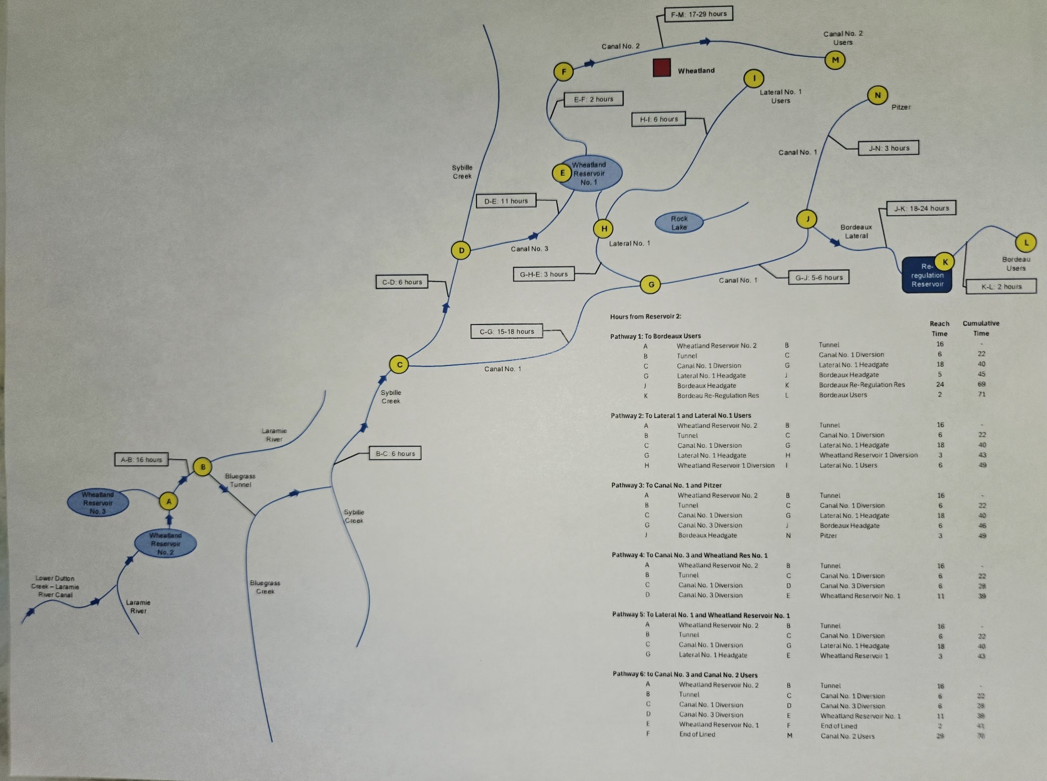
Water Delivery Travel Times
This map shows estimated travel times through the Wheatland Irrigation District canal system.
The route labels identify major reaches, divisions, reservoirs, and user delivery areas. Times shown on the map are approximate and are intended as a planning reference for water movement from Wheatland Reservoir No. 2 through the canal network.
Note: actual travel times may vary with flow conditions, canal operations, and field conditions.
Contact the District office for current operational guidance.